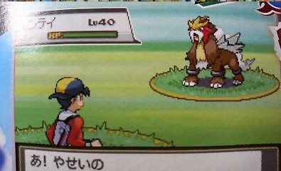
I like how the map now shows exactly which Pokemon are roaming. Haha the little Entei head. Notice there is a little "relevant area" green spot in the Ilex Forest. Is it marking the Celebi Shrine or the forest itself?
There are new areas on either side of Olivine. One might be the Miltank farm, but then what would the other one be (TAUROS RANCH LOL)?
The big thing for me is, it shows the route east of New Bark Town, which of course goes to the Elite Four, but it doesn't show the route connecting Indigo Plateau to Mt. Silver. But it doesn't even show Indigo Plateau at all. I take this to mean that you get this Johto map, and then when you can take your "first step into Kanto" it will roll over to the other map. Is this how GSC worked? I can't remember.
Yes, the route to Mt. Silver and Indigo Plateau were in Kanto and once you crossed a certain tile in Johto, the map would change accordingly.
And about the red dots you pointed out, the one to the right of Olivine is the National Park (it's not connected to Olivine, btw), while the one on the left must be the Battle Tower, and the green dot between Azalea and Goldenrod is Ilex Forest. Notice that the map has some green trees drawn together, representing the forest. However, there's also golden trees to the north of Ecruteak and, if you analyze the whole map, you'll notice that EVERY drawing represents a dungeon on the games: There's Ilex, Mt. Mortar. Mt. Silver, the entrances to Dark Cave, etcetera. Why would there be golden trees to the north of Ecruteak on the map if they weren't accessible, then?